Tjungundji
DISCLAIMER:
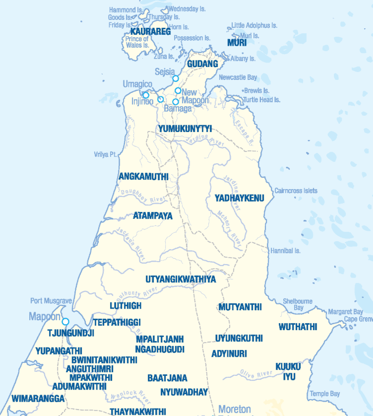
The locations of the language varieties of Cape York Peninsula shown on this map are not intended for Land Claim use, and are an approximate guide only. Individual language project locations are based on information from publicly available documents.
This map is a work in progress and is to be regarded as a dynamic draft. Pama Language Centre welcomes additions and corrections to the draft map and to information about the language varieties listed.

TJUNGUNDJI LIVING LIBRARY
Click here to explore the Tjungudji Library

According to Norman Tindale, the Tjungundji—also recorded under variant names such as Tjongkandji, Tyongandyi, Chongandji, Tjongangi, Joonkoonjee, Joongoonjie, Chunkunji, Chinganji, and Ngucrand (the latter possibly a horde designation)—were identified as a “Mapoon tribe.” Their territory covered approximately 400 square kilometres inland from Cullen Point, known in their own language (as transcribed by Walter Roth) as Tratha-m-ballayallyana. This area lay on the Port Musgrave coast, west of the Batavia River estuary, and extended southwards for about 24 kilometres to Janie Creek.
To be completed
| AUSTLANG reference | Y14 |
| AUSTLANG reference name | TJUNGUNDJI |
| OTHER REFERENCE CODE(S) | |
| LANGUAGE VARIETY NAME, PHONETIC TRANSCRIPTION | [ˈtʲuŋunʲdʲi] |
| LANGUAGE VARIETY NAME, PHONEMIC TRANSCRIPTION | /ˈtʲuŋunʲdʲi/ |
| LANGUAGE VARIETY COMPLEX | Anguthimri |
| LANGUAGE STATUS | |
| PRACTICAL ORTHOGRAPHIES | Standard Modern Tjungundji – Developed by Pama Language Centre |
| DICTIONARY | |
| FIND A TRANSLATOR | Xavier Barker, xbarker@pamalanguagecentre.org.au, 0433 994 182 |
| CONNECT WITH SPEECH COMMUNITY | |
